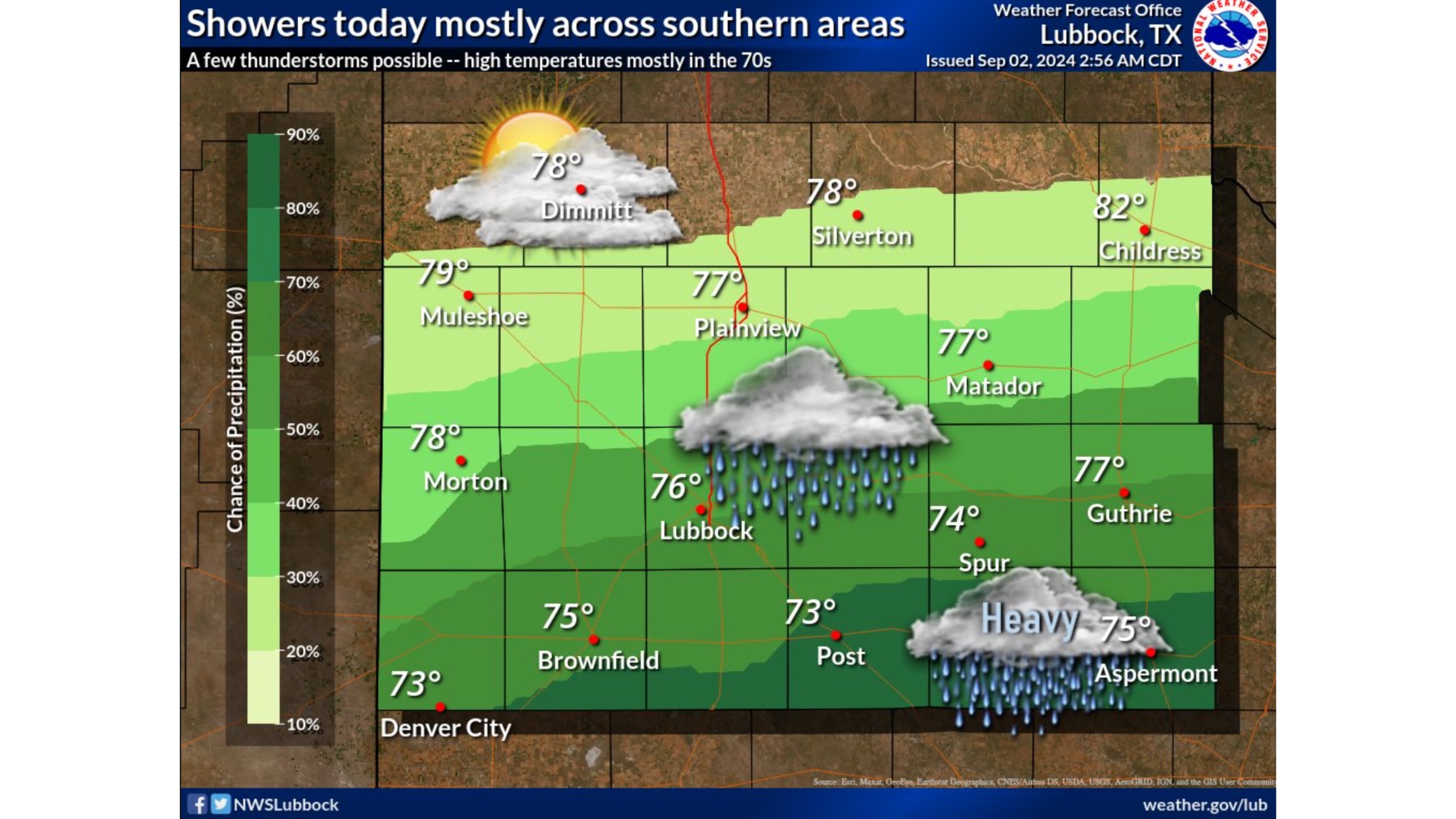
LUBBOCK, TX – The National Weather Service reported showers and thunderstorms in southern sections of the South Plains and Rolling Plains today with some possible locally heavy rainfall.
Showers are likely and the possibility of a thunderstorm before 1 p.m. is in the forecast, then a slight chance of showers between 1 p.m. and 4 p.m. during the holiday. A slight chance of showers and thunderstorms is forecasted after 4 p.m.

Lubbock National Weather Service
Cloudy, cooler, and rainy conditions are expected across most of the Lubbock area today as an upper-level disturbance moves over the region with temperatures in the mid-to-low 70s.
Locally heavy rainfall may lead to a risk for localized flash flooding, especially across the southern Rolling Plains but no severe weather is expected.
Winds will remain moderate, coming from the east-northeast at 10 to 15 mph.
A 30 percent chance of showers is predicted tonight, mainly after 1 a.m. Mostly cloudy skies with a low around the 60s. Winds will drop tonight coming from the north-northeast at 5 to 10 mph.
Much like the Labor Day holiday, Tuesday’s forecast is predicted to remain in the mid-to-high 70s with a 30 percent chance of showers and thunderstorms, mainly before 1 p.m.
The forecast predicts to be partly sunny with a high near 77 degrees on Tuesday with winds in the north-northeast at 5 to 10 mph in the afternoon.
Subscribe to the LIVE! Daily
Required


Post a comment to this article here: